
The overview
Popular haunts like the Barton Creek Greenbelt and Barton Springs Pool routinely see a rise in visitors beginning in April that ramp up over the summer, with over 90,000 individuals taking a dip in Barton Springs last May, according to Austin’s Park and Recreation department.
A frequent visitor of local parks and greenbelts, local Brian Leitner said these natural swimming spots are a “big piece” of Austin.
“The water is what brings me here,” Leitner said. “Austin’s my favorite city because it’s hot, it’s got culture, and I can jump in the water pretty much six to eight months out of the year.”
However, without much rainfall this year adding to persistent drought conditions in the area, the first question for many will be “Is there any water?”
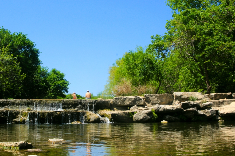
For now, some of Austin’s natural swim areas are flowing, while others still need steady rainfall to see measurable water volume.
Cubic feet per second, or cfs, is a common way to measure how much water is flowing through a stream or river at a given time. It reflects the volume of water moving past a specific point each second, and it can give a general indication of stream conditions—such as whether water levels are low, normal, or high.
Water levels in local greenbelts are variable and dependent on rainfall, while spring-fed natural swimming areas remain at a consistent temperature and water level, according to the city’s parks and recreation department.
Forecasts from the Lower Colorado River Authority, or LCRA—which oversees access to the Colorado River water supply for Austin—indicate the Hill Country will see slightly below average rainfall over the spring and summer months. LCRA chief meteorologist Bob Rose said the summer pattern currently shows only a few opportunities for rain, with “nothing sustained or heavy.”
This year’s current storm track is expected to be primarily across Oklahoma and North Texas, allowing fewer storms to make it south into Central Texas, Rose said. However, he noted other tropical storms and moisture could bring rain into the area.
Central Texas has remained under drought conditions since 2019, which was the last time the area’s two water supply reservoirs, known as the Highland Lakes system, were full. Both lakes Buchanan and Travis, which make up the Highland Lakes system, are currently under halfway full, according to LCRA data.
Should the dry spell continue, the current arid conditions could rival the “drought of record,” which was the area’s worst drought in history from 2007-2015.
The most recent five years of drought conditions have played a role in diminished water levels at some of Austin’s favorite greenbelts.
Recent efforts to modernize the city’s water use and management plan, known as Water Forward, indicate that Austin is projected to see longer, worse droughts in the decades ahead as Texas grows drier overall.
A closer look
Shannon Hamilton, the executive director for the Central Texas Water Coalition, said that rain is not the only contributing factor to lowering water levels.
“What’s changed significantly is how much water is flowing into our lakes,” Hamilton said.
She said that in Texas, property owners are legally allowed to dig out ponds or stock tanks on their property, typically to be used for agricultural or fishing purposes.
Central Texas has around 44,000 small ponds located in the higher-elevation areas where the region’s feeder rivers and streams begin, meaning these ponds must fill up before any runoff reaches the Highland Lakes system, Hamilton said.
Under state law, each of these stock tanks is allowed without a permit up to 200 acre-feet, which equates to a capacity of roughly 65 million gallons of water.
“They’re literally strangling us. They’re cutting off our water supply,” Hamilton said.
These trends come alongside a surge in demand, with Austin Water’s customer base estimated to triple over the next 100 years.
Additionally, the area’s growing data center industry adds exponential demand on local water supply, with one data center consuming millions of gallons of water a day to cool off hundreds of on-site computers.
Managing water resources has become an increased priority for local officials and conservationists alike—not only for municipal needs, but for sustaining the local environment, including swimming spots. In November, Austin City Council members approved a measure to amend the Water Forward plan, focusing on conservation.
Municipal demand historically has taken up around half of the total water consumption, according to LCRA data, and with a hotter, drier future forecasted, the strain on natural water resources is expected to increase.
Planning a trip?
For those looking to cool off in the greenbelt swimming holes but unsure about water levels, the LCRA provides real-time data for several creeks in the Austin area.
Find local water levels by looking at current streamflow and recent rainfall on https://hydromet.lcra.org/coa.
- Pack it in, pack it out
- Clean up after pets and dispose of waste properly, as animal waste can have an impact on water quality
- Pay attention to surroundings and be aware of others walking, rolling or riding on trailways
- Water levels can change quickly and without warning. Remain alert, even when conditions appear dry
- Watch for strong currents, obstacles, rocks and debris, especially after a heavy rain
- Always enter unknown or shallow water feet first
- Avoid algae in stagnant water. Green algae is widespread and generally not toxic, but toxic blue-green algae may still be present. Residents should treat all algae as potentially harmful