
Key
H - Hiking B - Biking E - Elevation gains
New Braunfels
County Line Memorial Trail
This linear, paved trail runs along and near the border of Guadalupe and Comal counties, and offers benches and rest areas along the path.
Distance: 2.18 miles
H B
Extends from County Line Road near FM 1044 to FM 725, New Braunfels
www.comaltrails.org/trails/county-line-memorial-trail/
Dry Comal Creek Trail
Winding through several different habitats within the city, this trail offers a variety of vegetation to admire, from various thick forested areas to savannas.
Distance: 2.25 miles
H B
Located off Loop 337 southeast of Landa Street near the little league baseball fields, New Braunfels
www.comaltrails.org/trails/dry-comal-creek/
Fischer Park
The 62-acre park offers more than 2 miles of greenway trails winding through its fishing ponds and lush nativescape fields.
Distance: 2 + miles
H B E
1935 Hilltop Summit Road, New Braunfels
www.nbtexas.org/3379/Fischer-Park
Panther Canyon
Located near the headwaters of the Comal Springs in Landa Park, Panther Canyon trail crosses a dry creek bed in a forested area of live oak, ashe juniper, cedar, elm and Mexican buckeye as it ascends the Balcones Escarpment to the Edwards Plateau.
Distance: 1.6 miles
H E
Located near the intersection of Ohio Street and Landa Park Drive
www.comaltrails.org/trails/panther-canyon/
Comal County
Canyon Lake Dam
The Canyon Lake Dam trail offers great views of Canyon Lake and the Hill Country on an easy, 1 mile round trip jaunt.
Distance: 1 mile
H
601 Coe Road, Canyon Lake
www.comaltrails.org
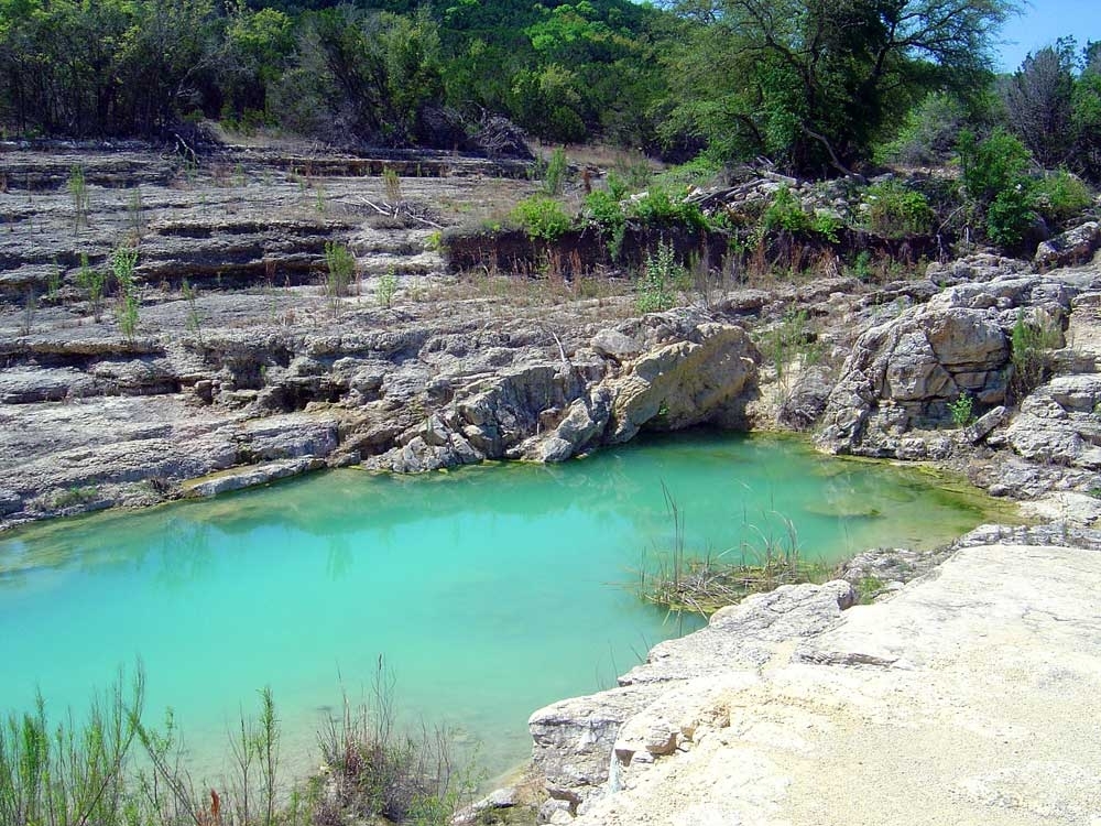
Canyon Lake Gorge
Created from the flood of 2002 that set off a torrent of water that breached the dam, the Canyon Lake Gorge offers a lesson in the history and geology of the Texas Hill Country and the exposed Trinity Aquifer. Tickets for guided and self-guided tours are available from the Guadalupe-Blanco River Authority.
Distance: 1.3 miles
H E
16029 S. Access Road, Canyon Lake
www.canyongorgetours.com
Guadalupe River Trail
This moderately difficult trail runs along the Guadalupe River where it exits Canyon Lake and begins its way towards New Braunfels. It is popular for both hiking and biking.
Distance: 1.8 miles
H B E
16510 S. Access Road, Canyon Lake
www.comaltrails.org
Madrone Trail
A rocky and demanding trail, the Madrone is popular among mountain biking enthusiasts for its rapid changes in elevation and obstacles.
Distance: 7.6 miles
H B E
1769 Canyon Park Road, Canyon Lake
www.comaltrails.org
Old Hancock Trail
This trail follows the lake line of Canyon Lake and has very little elevation change, making it an easy, relaxed hike or bike. Horseback riding also is allowed on this trail.
Distance: 3.5 miles
H B
Located at the end Hancock Road in Canyon Lake
www.comaltrails.org
Guadalupe River State Park
Situated along the Guadalupe River, this state park offers more than 13 miles of hiking and biking trails to explore, leading to a scenic overlook of the river.
Distance: various trails range from 0.3-2.86 miles
H B E
3350 Park Road 31, Spring Branch
wwwtpwd.texas.gov/state-parks/guadalupe-river
Curry Nature Center
This less than a mile loop is considered easy for hiking and walking, located near Canyon Lake.
H
1889 Skyline Drive, Canyon Lake
www.comaltrails.org/curry-nature-center
Worth the Trip
Government Canyon State Natural Area
Located just northwest of San Antonio near Helotes, Government Canyon State Natural Area offers more than 40 miles of hiking and biking trails that cross from easy rolling grassland hikes to rugged canyons. Some trails are for hikers-only and others accommodate trail running and mountain biking. Camping, picnicking and bird watching are all available at the historic site that features the only dinosaur footprints in Bexar County. The name stems from the 1850s when soldiers from Fort Sam Houston laid a military supply route through it to connect to western forts.
H B E
12861 Galm Road, San Antonio
www.tpwd.texas.gov
Hike prepared
Trail visitors should be prepared before their hikes or excursions with adequate supplies for hydration, protection from the outdoor elements and other essentials. In almost all these hiking areas, uneven surfaces and slick rocks are common and encounters possible with snakes, bees, wasps and mosquitoes. Hikers should bring or have available:
• water
• food
• proper shoes
• sun protection
• insulation
• bug spray
• socks
Source: National Park Service, Comal Trails Alliance/Community Impact