
During the Sept. 21 McKinney City Council work session, council members heard a presentation regarding the master plan and design concepts for city wayfinding signs.
The signs will act as a guide for all transportation modes and provide information to people entering city limits, directional arrows to major destinations, walking routes from parking garages or event centers, and more, the city website stated.
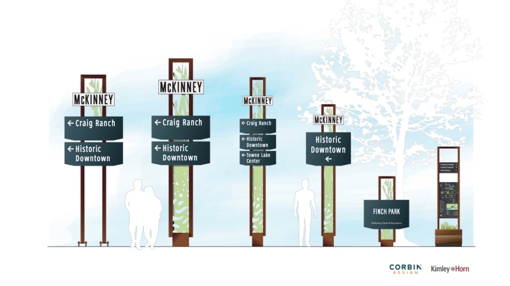
The signs can range from large monumental signs to smaller signs located on city boundaries, Jeff Frank, a lead designer for Corbin Design, told the council.
The selected design concept presented to the council was compiled following a July 15 open house. The design concept features natural wood-looking sign borders overset on sculpturally interpretative greenery.
“Our thought was that it shows the growth and development of the community,” Frank said.
Potential locations for the signs are city gateways as well as high activity centers, such as downtown and Craig Ranch and the upcoming downtown expansion on the east side of Hwy. 5, per Frank's presentation.
Council members briefly discussed options for nighttime illuminations for the streets, which Frank said is possible. The project team will next develop a location plan for the signs and finalize cost estimates for the city. Late this year or early next year the final design will be presented to the council, with the wayfinding sign project scheduled to go out for bid next spring, according to Frank's presentation.
More information is available at www.mckinneytexas.org/wayfinding.