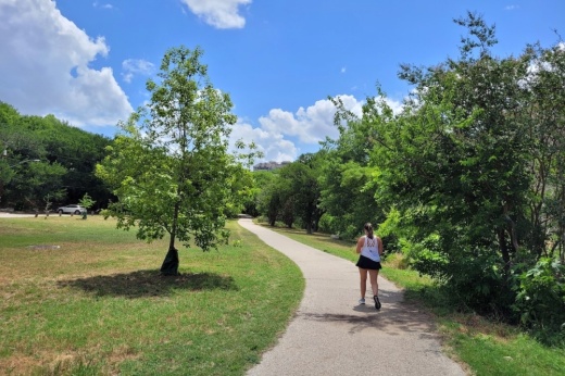
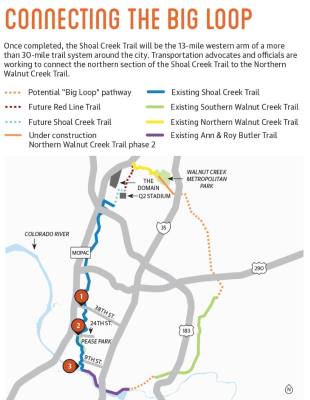
The Shoal Creek Trail, which currently runs parallel to the creek from Lady Bird Lake to Braker Lane north of US 183, will be a 13-mile western arm of the Big Loop—a more than 30-mile trail system around the city.
Nina Rinaldi, a project and policy manager with Shoal Creek Conservancy, manages the implementation of the community-guided vision plan for the trail, which was developed about five years ago. She said residents expressed the desire for a seamless, connected pathway throughout the entire Shoal Creek corridor that connects to other urban trails and green spaces.
Currently, the biggest gap in the Shoal Creek Trail is its northernmost section, which would connect it to the Northern Walnut Creek Trail. Rinaldi said Q2 stadium sits about a mile and a half away from the future nexus of these two trails.
“Connecting all of these trails to Q2 stadium is a really, really exciting opportunity because of just the sheer number of people that are going to these soccer matches,” Rinaldi said.
Several departments—including the Austin Public Works Department, Corridor Program Office, Transportation Department, and Parks and Recreation Department—have been involved in the project, depending on whether a given section of the trail meets the definition for an urban trail, runs through existing parkland or is in a street’s right of way.
Both Rinaldi and officials with the city said there are a couple projects in the works to connect Shoal Creek Trail to Northern Walnut Creek Trail.
First, the urban trails and corridor program office is working to widen the shared-use path proposed on Burnet Road to 12 feet between Longhorn Boulevard and Rutland Drive. Work on this segment of Burnet is expected to begin in 2023 and is part of a larger $45 million-$55 million program to improve safety and mobility on Burnet from Koenig Lane to MoPac, a spokesperson from the corridor program office said in an email.
Katie Wettick, Urban Trails Program manager in the public works department, said in an email that future on-street trails would connect to Q2 stadium and the existing Red Line Trail nearby.
Additionally, Wettick said using 2018 and 2020 mobility bond funding, the urban trails program is also in the design phase for a 1.7-mile project that would extend the Red Line Trail from Braker Lane to the Northern Walnut Creek Trail, connecting Q2 Stadium to the trail system.
“As far as getting to the stadium is concerned, I think we have some really great immediate opportunities with the corridor improvements and with the Red Line Trail to be able to make that connection,” Rinaldi said. Once completed, the Shoal Creek Trail will be the 13-mile western arm of a more than 30-mile trail system around the city. Transportation advocates and officials are working to connect the northern section of the Shoal Creek Trail to the Northern Walnut Creek Trail. Shoal Creek Trail Travelers
The city of Austin tracks pedestrian and bicycle usage of the trail at a few locations. Here is the number average daily users the trail saw over the past 30 days.* Shoal Creek Boulevard at 38th Street:
Shoal Creek Trail at 24th Street:
Shoal Creek Trail at Ninth Street: 492 351 147 Future Red Line Trail


