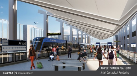
Now, Capital Metro and the Austin Transit Partnership, the local government corporation tasked with overseeing the $7.1 billion investment, are digging into the details, talking to the community and seeking feedback on questions such as which exact intersections will serve as station locations and whether riders will access the train cars from a center platform or from the side.
All of those decisions and public engagement are part of an estimated two-year federal environmental review process for the rail lines that Project Connect is currently going through. From there, the Blue Line from the Austin-Bergstrom International Airport to North Austin and Orange Line running from North Austin to South Austin will move into the final design and then the construction phase. Work is expected to start in 2024 and last approximately five years.
On May 19, ATP Chief of Architecture and Urban Design Peter Mullan and Deputy Program Officer John Rhone presented details of a proposed route and station locations to the board for a section of the line running between the airport and Lady Bird Lake. The locations, shown in the map below, are still very preliminary, according to Mullan.
At the intersection of East Riverside Drive and Pleasant Valley Road, the Blue Line would share a station location with Capital Metro's new planned MetroRapid line, a bus service that runs more frequently and has fewer stops than the public transportation agency's MetroBus services. Construction on that new bus line and Capital Metro's new Expo Center route is scheduled to start by the end of 2021.
After following Riverside Drive from the Airport through the Lakeshore area and the Travis Heights neighborhood, the line would take a right turn near the Austin American-Statesman's current home, where developer Endeavor is planning a mixed-use project including 12.5 acres of public space that will include a waterfront park.
The rail line will then cross Lady Bird Lake on an elevated bridge, connecting to a proposed downtown tunnel on the other side of the water near the Waller Creek Boathouse.
"This, I think is a really exciting opportunity to create some meaningful architecture, but also because we are imagining this bridge will not just carry the light rail system but also have facilities for pedestrians and bicycles," Mullan told the board. "This will be really a vital multimodal corridor crossing the lake."


