/https://static.texastribune.org/media/images/2017/08/30/Screen_Shot_2017-08-30_at_6.29.44_PM.png)


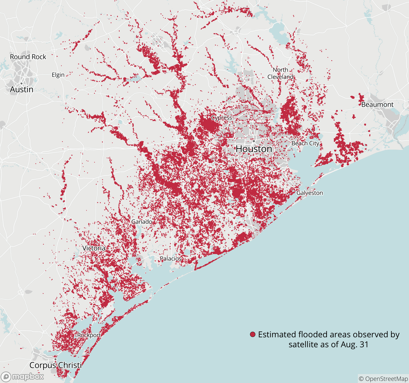
 Preliminary flood data collected by the Dartmouth Flood Observatory using satellite imagery shows the extent of flood water across Southeast Texas. Because cloud cover can limit the availability of data, this represents the minimum likely extent of the flood water. Ryan Murphy/Dartmouth Flood Observatory
Read related Tribune coverage:
-
Here’s what you need to know about filing Harvey-related insurance claims [Full story]
-
Hurricane Harvey ravaged the Texas Coast, and has left Houston grappling with unprecedented flooding. Do you need help? Or do you want to help those in need? Check out these resources. [Full story]
-
After Hurricane Harvey hit, Texans with kayaks and fishing boats spread out to help those in need. And then there's a guy in Houston who has been rescuing folks in his monster truck. [Full story]


