


The Woodlands’ task force was originally formed to discuss drainage issues following high-water events in 2015 and 2016, and it expanded its scope over five years to include topics such as subsidence, which is the gradual sinking of land due to excessive groundwater withdrawal.
At the April 21 board of directors meeting, Director Ann Snyder made a motion to continue the task force in 2022, stating she felt it was an important role for the township to serve even though it does not have jurisdiction over water matters.
Bruce Rieser, vice chair of the township board and former chair of the One Water Task Force, said the township’s municipal utility districts are more appropriate entities to facilitate those discussions as they have provided funding for studies related to drainage in the Spring Creek watershed.
“I don’t think we should be spending time or township resources to do it; it really is not our responsibility,” he said.Detention study continues
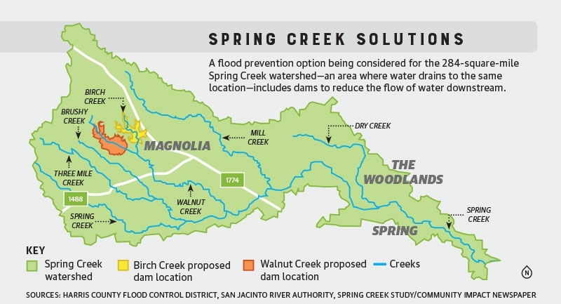
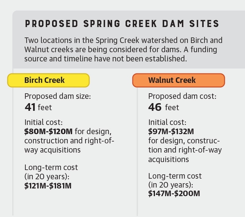
In addition to prompting the formation of the task force, regional flooding in 2016-17 also contributed to the development of the San Jacinto Regional Watershed Master Drainage Plan, which was completed in 2020 and identified 16 potential flood control projects. The ongoing Spring Creek Flood Control Dams Feasibility Study is one of those efforts. On April 7, the San Jacinto River Authority held its first public input meeting for a feasibility study regarding two potential dams on Birch and Walnut creeks.
According to the SJRA’s website, dams on the two rivers would initially cost $80 million-$132 million each at current rates. In another 20 years, costs will escalate to up to $200 million for each dam. A funding source and timeline have not been established.The creek dams would use pipes and a spillway to handle water, and the reservoirs would be dry bottom—meaning when rain does not fall, the area will be dried out, SJRA Division Manager Matt Barrett said.“The benefit [of this model] is that there’s less water coming downstream,” Barrett said.
Rieser said he believes the dams are the most likely of the plans proposed to be feasible.“This is the only one that shows any promise,” Rieser said. “If you take a significant portion of the water out between Kuykendahl [Road] and I-45, it benefits everyone downstream.”