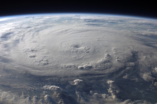
In a July 6 update, officials with the National Weather Service said Tropical Storm Beryl is forecast to strengthen into a category 1 hurricane before making landfall likely somewhere south of Matagorda Bay. The overall track forecast for Beryl has not changed much since July 5, with Jackson and Matagorda counties expected to be in the storm's path.
A hurricane watch—formerly issued for the area from Northern Mexico through Sargent, Texas—was extended farther east to San Luis Pass. A storm surge watch is also in effect for all coastal areas along the Gulf of Mexico and coastal bays.
The Houston area could see 6-8 inches of rain, enough to cause localized street flooding. Acting Gov. Dan Patrick announced July 6 that 81 more counties were added to a disaster declaration issued the previous day, including Harris, Montgomery, Fort Bend, Brazoria and Galveston counties.
“Based on the current forecast, heavy rain and some localized flooding could occur all the way from the coast through areas near College Station, Tyler, and Texarkana as the storm moves through Texas on its current track," Patrick said in a statement issued at around 1:15 p.m. July 6. "The track may change over the next 40 hours. Texans need to take heed, watch their local officials, and prepare today and tomorrow before the storm makes landfall early Monday morning."
City of Houston officials said they will temporarily lower Lake Houston by 12 inches to an elevation of 41.4 feet, starting at 4 a.m. July 7. The process is estimated to take 20 hours, and property owners are advised to secure property along the shoreline.
The Texas General Land Office advises Texans to prepare by:
- Monitoring storm systems
- Following the National Hurricane Center on Twitter and Facebook
- Reviewing the recommended Disaster Evacuation Checklist and have a “go bag” ready in case of evacuation
Updated 6:10 p.m. July 5
The National Weather Service has issued a hurricane watch from Northern Mexico through Sargent, Texas, for Hurricane Beryl, meaning residents in those areas should review hurricane plans and be prepared to act if a warning is issued.
Texas Lt. Gov. Dan Patrick has also issued a disaster declaration for 40 counties at 4:25 p.m. July 5, including counties as far east as Matagorda and Wharton counties. Most Greater Houston-area counties—including Fort Bend County and Brazoria counties, which border Matagorda and Wharton counties—were not included in the July 5 declaration.
Beryl is still slated to make landfall in South Texas late Sunday night or early Monday morning, according to the NWS. This story will continue to be updated as Beryl's track becomes more clear.
Posted 3:54 p.m. July 5
Projections for the path of Hurricane Beryl have shifted to the north, increasing chances for stronger winds, higher tides and heavier rains in the Houston area, according to a July 5 update from the National Weather Service.
Where and when Beryl makes landfall in Texas remains to be seen, but the latest projections show it could shift north toward the Matagorda Bay, said Dan Reilly, warning coordination meteorologist with the NWS's Houston/Galveston Branch.
The latest
Beryl was tracking over the Yucatan peninsula July 5 and weakening in intensity, Reilly said in a July 5 update. However, the storm has shifted north in track and may continue to shift farther north as it strengthens back to potentially a category 1 or category 2 hurricane again before making landfall in Texas Monday morning.
"Confidence is fairly low with this system as far as the intensity and track," Reilly said in a July 5 update. "With the steering currents as they are, slight shifts to the north and south will make a big difference in landfall and impacts."
What readers should know
No hurricane, tropical storm or storm surge watch notices have been issued for the Houston area as of 3:30 p.m. July 5, but NWS officials said they expected to release some watch notices for lower/middle Texas later in the afternoon.
Texas Gov. Greg Abbott announced he increased readiness level of state emergency operations to Level II, effective 10 a.m. July 5, and instructed the Texas Department of Emergency Management to begin readying response resources.
"Texas is prepared to quickly deploy all available emergency response resources to assist at-risk communities," Abbott said in a statement. "Texas continues to closely monitor weather conditions to protect the safety and well-being of Texans."
Officials with the Texas General Land Office also announced July 5 they are coordinating with local officials in the storm’s path as well as state and federal partners to ensure all preparedness and response measures are in place.
In a July 5 news release, Red Cross officials encouraged both coastal and inland residents to prepare for Beryl. Preparations should include:
- Making a plan to potentially leave home quickly and travel to a safe place outside the affected area with an evacuation kit with three days of supplies in a "go bag"
- Building a kit with a one-month supply of prescription medication and two weeks of emergency supplies, including food, water, hygiene items, cleaning and disinfectant supplies, cloth face coverings, infant formula and supplies, pet food, cash or traveler's checks and important family documents
- Stay informed of local weather alerts, and prepare for a way to stay informed in case of power outages
- Download the Red Cross Red Cross Emergency App to find shelter information and weather and emergency alerts for more than 35 different situations
As more details about Beryl become clear over the weekend, residents should keep the following definitions in mind:
- Hurricane watch: conditions are a threat within 48 hours. Review hurricane plans and be prepared to act if a warning is issued.
- Hurricane warning: conditions are expected within 36 hours. Complete storm preparations and leave the area if directed to do so by authorities.
- Tropical storm watches and warnings: Life-threatening flooding and dangerous winds are possible.


