
What you need to know
Cars will be directed to the east side of South Pleasant Valley Road, with one lane open to vehicles in either direction. Pedestrians and bicyclists using the Ann and Roy Hike and Bike Trail will also be rerouted to the east side of the roadway.
Canterbury Street will continue to serve as a detour for trail users, with vehicle traffic flowing in only one direction westbound.
What else?
The latest update from the city indicates that the construction of the support system for the bridge is expected to be completed by the beginning of the year, while crews will continue work on the new underpass through May.
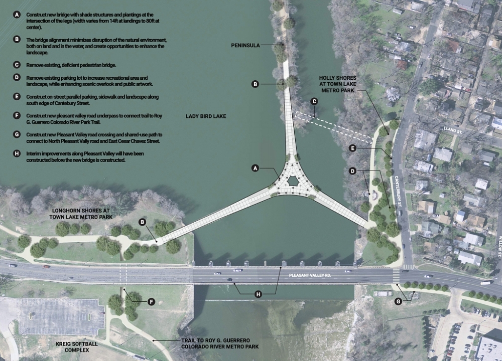
Dubbed the “wishbone” bridge by city officials, the new three-pronged bridge will connect Longhorn Shores on the lake's southern banks with Holly Shores, and a peninsula of the Ann and Roy Butler Hike and Bike Trail to the north.
Plans for the bridge include more than 2,000 feet of 30-foot-wide walkway and a floating plaza area at the intersection of the three bridge segments.
The bridge is expected to be fully completed by the summer of 2026, and the project is being funded by both 2016 and 2020 mobility bonds as well as a federal grant.
Find more information on the project here.