
In a nutshell
“By building this second evacuation route, we are improving the safety of Steiner Ranch and Montview residents in the case of fires or other disasters,” Precinct 2 Commissioner Brigid Shea said. “This is how we make our community more resilient in the face of growing climate disasters. I'm grateful for the work of our Travis County staff, area residents, [Emergency Services District No.] 6 and many other partners.”
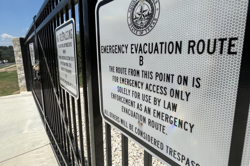
The new route—running from Flat Top Ranch Road to RM 620—is designed to provide an additional evacuation route out of the Steiner community in the event of an emergency where evacuation is required, a county press release states.
The why
County officials included the new route in plans for capital improvements after a wildfire wreaked havoc for the neighborhood in 2011.
The Austin area has ranked among the top at-risk communities for wildfires in recent years, with the most high-risk homes concentrated along greenbelts, canyons and rural areas.
In 2012, Steiner Ranch residents formed a new neighborhood association—separate from the Steiner Ranch Homeowners Association—to address concerns about the wildfire that impacted the neighborhood the previous year.
When the association first formed, former communications chair Paul O’Brien told Community Impact the greatest concern was that it took several hours for residents to evacuate because there was only one way in and out of the community.
The details
The master plan for the Steiner Ranch development includes more than 10,000 residents on roughly 4,600 acres.
The county analyzed 12 potential vehicle evacuation routes and narrowed it between two—Route B and Route F, according to county documents.
Route F was determined to be the most effective route for moving emergency vehicles into the community and personal vehicles out of the community. However, the county ultimately went with Route B as it was fully funded with previously allocated 2017 certificate of obligations bond funds.
Route B was lower in cost and could be built in a shorter time frame, according to the county. Compared to the $7.2 million estimated for Route F, this emergency roadway cost $650,000.
Construction of the new evacuation route began in February 2023 and was completed earlier this year.
Though Route F was eliminated due to costs, if funding should become available, it could be pursued in the future as an additional evacuation route for the area, according to county documents.