The big picture
New data shows a 15% increase in rainfall intensities in Williamson County, with precipitation rates rising over the past 20-30 years, said Wesley Wright, Georgetown systems engineering director and floodplain administrator, in a presentation at the meeting.
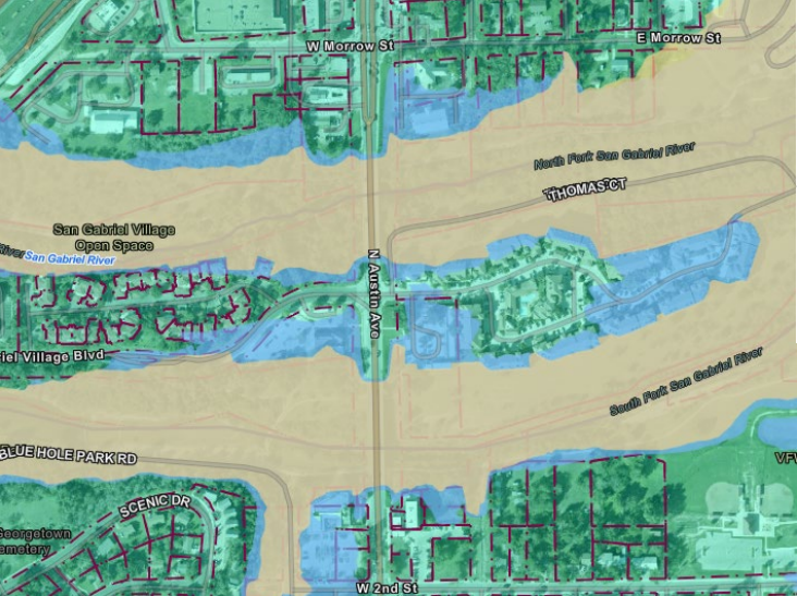
The Federal Emergency Management Agency has an online floodplain management map, which allows residents to analyze floodplain data.
However, since FEMA only updates their maps every 30-40 years, Wright said, Williamson County and the Texas Water Development Board’s 2021 Atlas 14 floodplain study contains more accurate information.
“There are properties that are not in the current mapped FEMA floodplain that Williamson County's Atlas 14 study shows would be—or should be—in a FEMA map update,” Wright said.

Per Wright’s suggestion, council members agreed new data could mean updating the city’s drainage criteria manual. Officials also agreed to explore FEMA’s community rating system, which would help educate the public on flooding and potentially reduce the likelihood that properties will flood, Wright said.
Terms to know
According to the TWDB and Wright’s presentation, the following flood terms can be defined as:
- Flood risk: the probability of a flood event happening and its impact
- Flooding: water overflowing onto normally dry land, caused by rising water or rainfall
- Floodplain management: a community-led effort to prevent or reduce the risk and impact of flooding
- Floodplain: a geographic area subject to flooding or land adjacent to a waterway necessary to contain a flood
What residents should know
City restrictions are in place to limit what can and can’t be done within a floodplain, which Wright said is regulated to:
- Protect the health, safety and welfare of the public
- Prevent damage to real property
- Allow citizen participation in the National Flood Insurance Program

“If you're out of the floodplain right now, it's strongly encouraged for you to get flood insurance because it's going to be very cheap,” Wright said, since FEMA’s maps don’t currently include Atlas 14 data.
The verdict
Council members agreed to look into FEMA’s community rating system, a voluntary program that uses a scale system and gives flood insurance discounts to individuals within participating communities that receive high ratings. Properties with the highest score—a 1—get a 45% discount on flood insurance, Wright said.
“That sounds like that could be something that would be a benefit to the citizens here in Georgetown,” District 1 council member Amanda Parr said.
City officials also agreed to consider updating the drainage criteria manual, which establishes Georgetown’s stormwater management system standards. The manual hasn’t been updated in over a decade, Wright said.
Looking ahead
Williamson County officials expect to release the Atlas 14 floodplain study’s findings by early 2025; however, officially updating the county’s data for FEMA’s maps is a separate process—and comes with a roughly $3 million price tag, Wright said.
“Floodplain management in the city is not Williamson County's responsibility—it’s ours,” Wright said. “There might be a cost sharing with that that they seek.”
Once the study’s findings are published, officials will consider updating the FEMA maps, Wright said, which could depend on what the county and city’s fiscal year 2025-26 budgets allow.


