Digging deeper
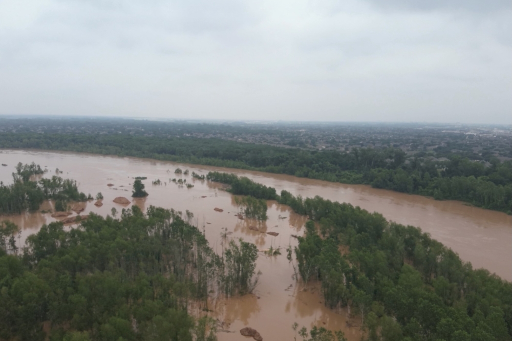
According to streamflow data on the Brazos River Authority's website, the Sugar Land gauge at Hwy. 59 measured 58,200 cubic feet per second—a streamflow of about 28,000 cfs more than it was at the same time May 2. Engineers used predictive modeling and gauges to predict the river level at the Sugar Land gauge will peak at 67.4 feet above sea level around noon May 11, according to the website.
That level remains in the “minor” stage; however, the Sugar Land site would enter the “moderate” flood stage if it rose further to 68.5 feet above sea level.
Additionally, the National Weather Service issued two river flood warnings at the Hwy. 59 gauge and on the Rosharon gauge at FM 1462, Fort Bend County officials said at a May 8 news conference.
What this means
Most parks and roadways along the Brazos River are expected to stay open, but the connector road between Brazos River Park and Memorial Park as well as the mountain bike trails will close May 9 due to minor flooding, Sugar Land Communications Director Doug Adolph said in an email.
The parks are in the river’s floodway, meaning it’s designed to hold floodwaters. Elsewhere, residential areas near the Brazos River are protected by manmade levees, Adolph said.
“Residents are encouraged to remain away from the Brazos River until conditions improve; sightseers have wandered dangerously close to the Brazos River when it has crested in the past,” a May 7 Facebook post from the city of Sugar Land read. “Fast-moving currents, loose soil, snakes and excessive ants pose a real threat.”
What they're saying
At the May 8 news conference, County Judge KP George said the county’s Homeland Security & Emergency Management office has been monitoring the river levels and will ensure residents are well-informed.
“It is crucial that everyone understand the potential threat possibly coming our way or our area can face,” he said in the livestreamed video.
George encouraged residents to reach out to their neighbors—roughly 80% of whom weren't born in the U.S., he said—and explain what to expect with the rising river levels.
Potentially exacerbating river levels is anticipated rainfall later this week, county officials said.
Zooming in
The Brazos River watershed is 1,050 miles and comprises 44,620 square miles, according to the Brazos River Authority's website. Judi Pierce, public information officer with the Brazos River Authority, said multiple storms happening upstream in Central Texas since May 1 are contributing to the flooding in Fort Bend County.
“Mostly it’s rainfall in Central Texas that is on the main stem of the Brazos, and there’s not a flood control reservoir to catch that as it’s heading down the Brazos,” she said.

Rising water levels along the Brazos River come after areas around the east and west forks of the San Jacinto River into Lake Houston flooded May 2-5, leading to school closures and residents having to evacuate.
During the May 7 Commissioners Court meeting, Harris County Judge Lina Hidalgo said there were 233 rescues that took place during the incident with 186 pets also saved, Community Impact reported.
What’s next
Residents can monitor Brazos River levels here and weather information from the NWS here. Additionally, Sugar Land residents can sign up for emergency alerts here.


