
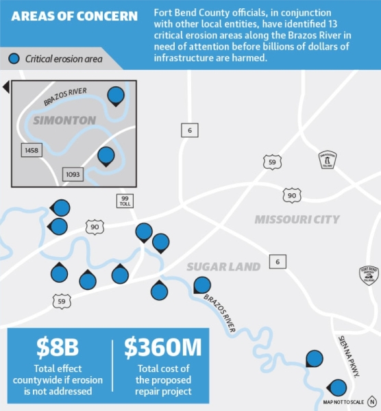
In December, Ken DeMerchant, Fort Bend County Precinct 4 commissioner, met with local and state elected officials and shared that the effect of erosion could be $8 billion affecting over 700,000 residents countywide if the issue is not addressed. This includes homes, businesses, levees, parks, bridges and other infrastructure.
Erosion occurs when high volumes of rain move through the river rapidly, eating away at the river banks.
Rain events, such as Tropical Depression Imelda in September, Hurricane Harvey in August 2017, the Tax Day flood of 2016 and the Memorial Day flood of 2015 have caused concern.
“The events from [2019] have had little impact on the river. The erosion that occurs along the river is due to rainfall upstream of the city and county that creates major flood stage and flow rates that reach above 70,000 [cubic feet per second],” said Chris Steubing, Sugar Land assistant city manager. “It is at this flow rate where velocities within the river start to impact the sand layer at the toe of the slopes where we have seen the most aggressive erosion.”
According to a release from Fort Bend County Precinct 4, a viable solution to prevent further erosion from occurring is to implement sloped stone dikes along the banks of the river.
This project would cost about $360 million, and funding would come from state and federal sources.