
Atlas 14 is a study of rainfall data conducted by the National Weather Service that was published in September 2018. The rainfall values are used to determine future flood risks and manage development in flood plains for the Federal Emergency Management Agency's national flood insurance program.
Atlas 14 also helps entities with design infrastructure and plan activities under federal, state and local law.
The study found Central Texas is more likely to see larger storms than previously thought, according to a presentation by Mark Vogler, Fort Bend County Drainage District engineer.
More specifically, Fort Bend County's 100-year, 24-hour rainfall event changed from 12.5 inches to 16.5 inches. A 100-year storm event has a 1% chance of happening in a year.
Fulshear City Council adopted the Fort Bend County Drainage District plan in 2003, but there have been some updates due to recent findings. Before Atlas 14, new structures were required to be 2 feet above the existing 500-year water surface elevation, 2.5 feet above the 100-year water surface elevation and 1 foot above any down gradient roadway or drainage restraint.
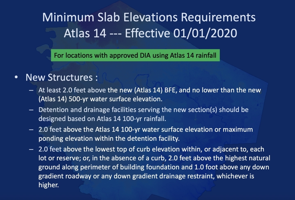
The new standards dictate that new structures be 2 feet above the new Atlas 14 base flood elevation and be no lower than the new Atlas 14 500-year rainfall and the existing estimated 100-year base flood elevation. New structures should also be 4 feet above existing estimated 100-year base flood elevation.
"I've seen these presentations several times and I think [flooding is a common topic among] many people in and around the area of Fulshear," Council Member Joel Patterson said. "The work that has been done here is very important. When people issue concerns about development, I refer to this Atlas 14 study, so I appreciate that very much."