
A meeting was held Aug. 17 to inform residents of the updated designs to the project. The project—which spans 1.5 miles from Shepherd Drive to Michaux Street—is expected to increase safety and multimodal connectivity, decrease the number of vehicle lanes for a slower vehicle speed, add safer crossing for people who are walking or biking, and add on-street barriers such as armadillos to have separated bike lanes, according to city officials with Houston working on the project.
Lauren Grove, senior staff analyst with the. Houston Public Works Department, said the city took the project on in response to feedback from the residents about safety along 11th Street. With crash data collected, she said it was apparent the street needed to be redesigned.
“We continue to hear that addressing safety on 11th Street is necessary,” Grove said.
At the time the resident complaints were coming in, 11th Street was on the list to be rehabilitated by 2025. It will also undergo milling and overlay to align with the timeline of the bikeway project.
The project includes maximizing the impact of the right of way and identifying areas for improvement, such as sidewalks and curb ramps, while being sensitive to the historic blue tiles. If tiles are affected by required curb repairs, they will be replaced, officials said at the Aug. 17 meeting.
Along the stretch of the road, different areas will have varying safety and multimodal structures in place.
Shepherd Drive to Yale Street
A concrete medium will be put in at Dorothy Street with a shared-use crosswalk restricting left turns. A separate project on Shepherd and Durham drives will complement this stretch of the 11th Street project with a shared-use path for the Dorothy Street bikeway.
Once drivers approach Lawrence Street, they will notice a replacement of the existing standard crosswalk with a high-visibility crosswalk that will require a stop for pedestrians.
To address complaints from Heights residents, a pedestrian refuge will be implemented at Nicholson Street, restricting left turns and through movements.
Once residents approach Yale Street, there will be a concrete median restricting turns at Allston Street. However, left turns will still be allowed at Yale Street.
Upon completion, this stretch of the project will feature two main lanes with bike lanes on each side. Bike lanes will be indicated using green pavement markings and discrete raised curbs.
Yale Street to Height Boulevard
Throughout this stretch, there will be improved crosswalk markings on the north and south areas of Heights Boulevard through the use of high-visibility crosswalks, new shared-use crosswalks and pedestrian signals.
There will also be floating bus stops to accommodate bike lanes and the bus route operated by the Metropolitan Transit Authority of Harris County. This will allow the bike lane to continue without sharing space with the bus, officials said.
However, with the changes, residents will no longer be allowed to make left turns onto 11th Street from Heights Boulevard and vice versa. Grove said those changes are intended to improve safety.
Heights Boulevard to Studewood Street
Because of the schools in the area, Grove said she was made aware of a need to implement more safe crosswalks in this section. This portion of the project will add a pedestrian refuge island at Columbia Street to alleviate any worry for those traveling on foot to Heights High School. There will also be a refuge island on the western leg of the intersection, but it will not be a full closure, so left turns and through movements will still be allowed.
Grove said she also heard from customers of Buchanan’s Native Plants that there was a need for a high-visibility crosswalk on Oxford Street for those who walk to and from the store. On the eastern portion of the intersection, there will also be a high-visibility crosswalk at Beverly Street and across both the north and south sections of the street.
Grove said she heard residents complain about the difficulty of making left turns at Studewood. Work will be done to improve the signal for the separate phases of traffic with one phase in place for the left turn, she said.
All of the updates for this portion have been newly added since the previous meeting, Grove said. This portion of the project will feature three lanes, one of which is a center turn lane with two bike lanes on each side.
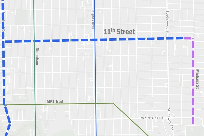
Studewood Street to Michaux Street
Grove said she heard there was a need for a protective crossing for students who attend Hogg Middle School. To make their travel safer, a high-visibility crosswalk and a pedestrian refuge island will be implemented on Northill Boulevard, a new element to the plan. However, these two will only be on the western leg of the intersection, so people driving will still be allowed to make a left turn.
For this section of the project, residents can expect two lanes with bike lanes on each side.
Michaux Street from 11th Street to Stude Park
Grove said city officials want this stretch of Michaux Street to be a neighborhood bikeway.
The area has on-street parking and speed bumps. With the project, there will be added bikeway markings. For this portion, nothing about the street itself will change; residents can expect two lanes with arrows to show the intended use of the road.
At White Oak Drive there will be a bicyclist refuge island to help slow vehicle speeds to address safety concerns.
Next steps
Over the next few weeks, residents can expect a door hanger and post on NextDoor about the rehabilitation for the mill and overlay that is slated for September. Around the same time, the final design for 11th Street will be released. Construction for the 11th Street project will begin in October with completion in February 2023.
In August 2023, a follow-up assessment will be done. The city will look at cut-through traffic data alongside crash data and traffic volume data. The city will then use Let's Talk Houston to provide information and updates to the community.