
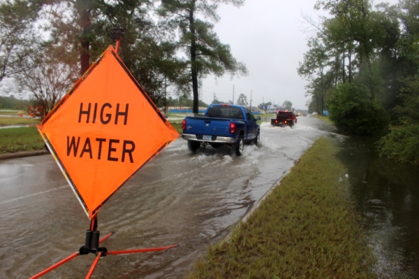
Home buyouts and elevations, additional greenspace and better street design were all explored over the course of a year and half in workshops between Houston officials and flood mitigation experts from the Netherlands and New Orleans. An extensive summary of those workshops was released Jan. 30 in a report titled "Living with Water."
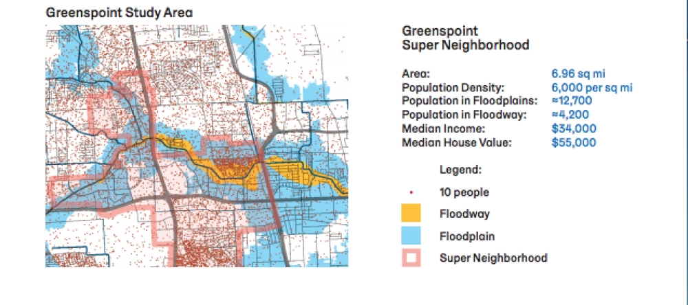
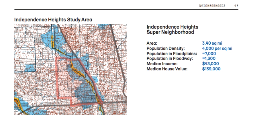
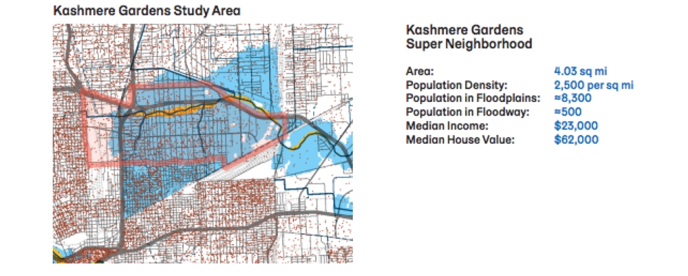
Using Kashmere Gardens, Independence Heights and Greenspoint as pilot areas, the workshops evaluated the level of risk residents face and the solutions that could reduce the number of people in harm’s way. These neighborhoods have significant numbers of homes and businesses within the 100- and 500-year floodplains.
Many strategies proposed in the report can be applied to other neighborhoods or benefit downstream areas, the report stated.
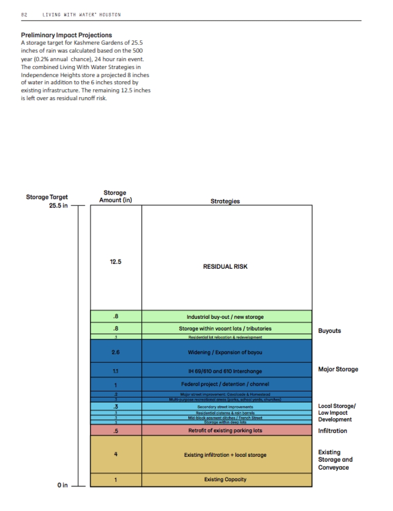
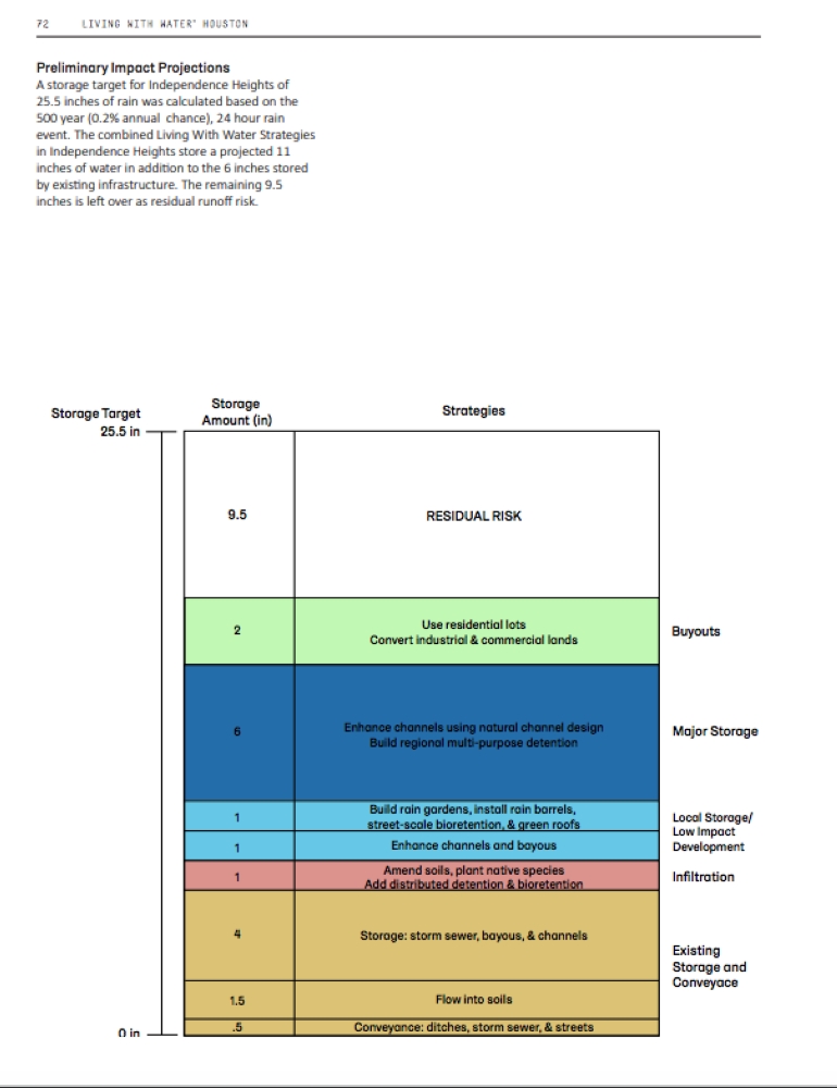
Even with all proposed mitigation efforts in place, the estimated storm water risk during a 500-year flood event in two of the study areas, Independence Heights and Kashmere Gardens, would be 9.5 and 12.5 inches respectively, the report found.
Other U.S. cities participating in the workshop have used the findings to secure federal grant funding and amend development policies, the report stated.
“This report serves as a guide and a call to action, not only to City departments but to all Houstonians, to make sure that our city is ready for a future where we live with water and will thrive as a place of opportunity, equity, and resilience,” Mayor Sylvester Turner said in a news release regarding the report. “I encourage everyone with a stake in our city to use it as a guide.”
Here are some key takeaways from the report, a summary of the workshops’ findings.
Reckoning with relocation, renovation
Collectively, the report found that the three pilot neighborhoods include nearly 30,000 residents living within either the 100 or 500-year floodplain and 6,000 residents in the floodway, the most flood-prone zone in the city.
While improving detention and drainage can mitigate risk, the report emphasized buyouts and home elevations. In areas with a high percentage of low-income residents such as those studied in the report, buyouts should be accompanied by safe, affordable alternatives within the community. It suggested a “buy-in” effort in which a group of neighbors agrees to a land swap could ease fears of community displacement.
Rethinking street design
To better address downstream runoff, the report proposes “Interceptor Streets” atop underground drainage channels that absorb water through porous pavement, preventing issues caused by clogged drains.
The report also recommends rethinking highway design with more porous frontage roads, a smaller footprint for parts of the proposed I-45 expansion and projects to correct the bottleneck effect caused by some freeways. Plans to address any bottlenecks such as the one caused in Independence Heights by Loop 610 need to come with mitigation plans for downstream flooding, the report stated.
Greater greenspace
To absorb more runoff, the report affirmed local efforts to create as much greenspace as possible along the city’s bayous. Since 2012, Houston, Harris County and several private partners have been buying land and converting it to public greenspace along all of the city’s bayous, an effort known as the Bayou Greenways 2020 initiative.
Following a similar model, the report proposes a “Green Collar" along the Northern edge of Kashmere Gardens which could help divert storm water from the neighborhood.
View the full report here.