

Harris County officials are preparing to embark on a yearslong, $25 million effort to remap flood plains throughout the county, a process that is intended to provide a better understanding of where flooding will occur during various rainfall events.
However, developers continue to target land parcels for new projects that are in or adjacent to county flood plains, and officials say they are required to use existing flood plain maps to determine how those developments should be regulated, sparking concerns among some residents and advocates with flood-control groups.
Flood plain maps are used for setting flood insurance premiums as well as determining what kinds of regulation developers need to follow to reduce the likelihood of flooding in certain areas, according to officials with the Harris County Flood Control District.
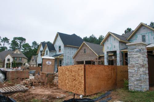
Recently proposed developments in Cy-Fair include new housing projects on undeveloped land near Cypress, Langham and Little Cypress creeks.
Chistof Spieler, a project manager with the Greater Houston Flood Mitigation Consortium, said regulations have been effective at preventing new development from flooding, but it is less clear how effective they have been at keeping new developments from making flooding worse at older developments downstream. The consortium was formed in October 2017 to help guide decision makers in the Greater Houston area on how to prevent future flooding.
“We know that [one] of the most effective strategies to reducing flooding [is] preserving green space along waterways and building regional detention,” Spieler said.
Current oversight
When a developer wants to build in unincorporated Harris County, the project first must be approved by the Harris County Engineering Department, which seeks input from the HCFCD.
Marcus Stuckett is the manager of the HCFCD’s Watershed Management Department, which he said lends technical support to the engineering department, including the review of drainage reports to make sure a development does not restrict the flow of stormwater.
As of Jan. 1, 2018, any development proposed on land that is below the 100-year flood plain must be elevated at least 24 inches above the 500-year flood level, Stuckett said.
The 100-year flood plain refers to areas that have a 1 percent chance of flooding in any given year. The 500-year flood plain has a 0.2 percent chance of flooding in any given year. Harris County also requires any development below the 100-year flood plain to have no net fill, meaning any dirt added to the site has to be excavated from elsewhere on the site.
“If [developers] take in two spoonfuls of dirt, we expect them to excavate that someplace else,” Stuckett said.
Stuckett said no development is technically approved within a Harris County flood plain. To get a development approved a developer must submit a Letter of Map Amendment or Revision to the Federal Emergency Management Agency that results in a redrawing of the flood plain so that the site in question is removed, either by raising the base elevation or adding detention facilities.
“There should never be a site bringing in dirt without it being approved by a Letter of Map Revision,” Stuckett said.
Jill Boullion is the executive director of the Bayou Land Conservancy, which works to preserve undeveloped land along Houston streams, a mission she said serves both environmental and flood control purposes.
Boullion said although her organization is not anti-development, it is more important than ever to leave land along streams undeveloped to serve as buffers. She said she thinks Cypress and Spring creeks are especially vulnerable to flooding due to upstream development.
“Even with elevation and detention, building in the flood plain puts people at increased risk,” she said. “Adding elevation may protect the structure from flooding, but it could present a life and safety risk nonetheless.”
Keeping new development dry
Spieler said there is evidence to suggest the development regulations in place before Hurricane Harvey were effective at reducing the number of buildings that flooded during the storm, and newer developments in general have flooded at a lower rate than older developments in recent storms.
“These new regulations [from Jan. 1] have further strengthened that,” he said.
Data gathered by the HCFCD after Harvey showed less than 1 percent of the structures that flooded were in developments built in or after 2009, Stuckett said. Many older homes were built slab-on-grade, meaning the finished floor of the structure is placed directly on the ground, he said.
“A lot of times the road was higher than the lot itself,” Stuckett said. “Those areas tend to take on water faster.”
The county strengthened those rules as well in January, requiring the slab to be 18 inches above the centerline of the road, Stuckett said.
The remapping of the flood plain, which could run through 2023, will provide better insight into how development should be regulated, said Todd Ward, assistant manager of the HCFCD’s Risk Mitigation Department.
Ward said the HCFCD is using new methodologies that will make it possible to study smaller drainage areas, so new maps will include smaller streams that were left off previous maps. The HCFCD is also working on a plan to provide flood plain administrators—including those in cities such as Houston and Jersey Village—with new information before the maps are finalized, he said.
“We’re discussing how they might be able to adopt some of our results so they can protect against risk as we understand it, even if [the maps] have not made official by FEMA yet,” Ward said.
Protecting old development
Starwood Farms, a luxury townhome project, is expected to open around spring 2020 on Telge Road just north of Cypress Creek. A portion of the 26-acre land parcel is within the flood plain.
Senior Project Manager James White said he did not believe the parcel had significant flooding outside of the 100-year flood plain, where the homes would be built, during Harvey or the Tax Day floods in 2016. He said his team worked with the HCFCD to set aside 8 acres for future channel improvements to help increase stormwater conveyance.
“Additionally, we designed the site to ensure all townhomes are elevated above the 500-year flood plain base flood elevation, which is in accordance with the new Harris County flood plain regulations,” White said in an email.
However, homeowners who live in the Enchanted Valley community—located downstream of Starwood Farms along Cypress Creek—have expressed concerns about the project.
After the project was announced, Enchanted Valley resident S. Clarke Ohlendorf said he began speaking with his neighbors and eventually contacted developers with his concerns.
“The current land is vacant and acts as an avenue for absorbing some of the rains we receive before they go to Cypress Creek,” he said. “Once that land is developed and covered with additional concrete, it will move more water toward the creek and absorb less. This will almost certainly lead to greater likelihood of flooding for our neighborhood.”
Ward said Harris County has regulations in place that are meant to offset any increase in stormwater runoff rates caused by the placement of impervious surfaces such as concrete. Spieler said the consortium is working on a more thorough analysis of these regulations and hopes to release a report by the end of the year.
“It’s a very important issue, and it’s got a lot of dimension to it,” he said.
Subdivision plats submitted to the Houston Planning Commission over the past year indicate several other developments have been proposed in or near the 100-year flood plains in Cy-Fair.
Lennar has proposed a 55-acre community partially in the 500-year flood plain in Little Cypress Creek. Pulte Homes has proposed building a home community north of Langham Creek at the northwest corner of West Little York Road and Hwy. 6, but company officials said many details are still to be determined and the land has not been purchased yet. Developers are allowed to submit subdivision plans to the Houston Planning Commission even if they do not own the land.
Both Boullion and Spieler declined to comment on the potential effects of any specific project that has been proposed.
Stuckett said if a resident is worried about a proposed development making flooding worse, he or she can call his department to express concerns. He said he has fielded a lot more calls since Harvey from people asking questions about different developments.
“I’ll research the project and let them know what’s been approved,” he said. “What people don’t like is just not knowing. That creates the fear that something nefarious is taking place. If you can explain the process, that makes most people OK with what’s happening.”