
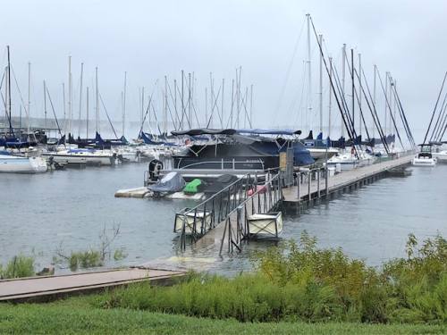
Update Oct. 16 11:12 p.m. At 11:06 p.m., the National Weather Service in Austin San Antonio posted a flash flood warning for northwestern Travis County until 5 a.m. Wednesday. According to the NWS statement, locations that will experience flooding include Austin, Cedar Park, Lakeway, Lago Vista, Bee Cave, Hudson Bend, The Hills, Spicewood, Mansfield Dam, Jonestown, Briarcliff, Point Venture and Volente. The warning stated residents along the lower banks of Lake Travis, especially those near Graveyard Point at Lakeway, should be prepared for several feet of water entering homes. Burnet County is also under a flash flood warning. Update Oct. 16 8:40 p.m. As of 8:30 p.m., the Lower Colorado River Authority has updated its reading of Lake Travis to 688.6 feet. 681 feet is full for Lake Travis. The fourth gate at Mansfield Dam opened at approximately 7 p.m. Update Oct. 16 12:30 p.m. Lake Travis is projected to rise at rates of up to about one foot per hour at times today, the LCRA said, and to within a range of 690 to 695 total feet over the next one to two days. Lake Travis was 86 percent full Tuesday morning at 672 feet. The historical October average is 664 feet. Original post The Lower Colorado River Authority closed lakes Travis, Marble Falls, LBJ, Inks and Buchanan Tuesday morning until further notice, according to a press release from the LCRA. Floodgates at Mansfield Dam and Tom Miller Dam will open Tuesday at noon. A second gate at Mansfield Dam will open at 2 p.m., a third gate at 4 p.m. and a fourth gate at 6 p.m. Water will be moving fast through lakes LBJ, Marble Falls and the upper end of Lake Travis as the flood water passes through the lakes, information on the LCRA website said. Water will be higher than usual at the upper ends of lakes LBJ, Marble Falls and Travis. “People in the area need to take action to protect people and property, and also stay away from the lakes,” LCRA Public Information Officer Clara Tuma said to Community Impact Newspaper. “This is not a day to go on a boat ride. These flows are serious. This is a serious flood and people need to treat it that way.” The level of Lake LBJ at Kingsland near the 2900 bridge will be 10-12 feet or higher than the normal water level, the LCRA said. Inflows to Lake Marble Falls are being passed through Starcke Dam with all 10 floodgates open. The level of Lake Marble Falls will rise 8 to 12 feet above the normal range at the dam and could be more than 30 to 35 feet higher than normal at the upper end near Wirtz Dam. The heaviest rain has fallen generally along a line from Harper to Llano to Lampasas, the LCRA said. The Llano River and Sandy Creek are well above flood stage and rising as rain continues to fall in the area. "This water will flow through lakes LBJ, Marble Falls and Travis overnight Oct. 15-16," the LCRA said. "Hydroelectric generation and floodgate operations are in progress at Wirtz and Starcke dams to pass floodwaters through Wirtz and Starcke dams. Releases from Starcke Dam will be caught in Lake Travis causing the level to rise very quickly." Storm runoff from areas upstream of Buchanan Dam will be caught in Lake Buchanan, which will also rise. The watershed is saturated and conditions can change quickly with additional rainfall. Unscheduled releases from the Highland Lakes dams may occur suddenly and unexpectedly at any time due to emergency hydroelectric generation or other reasons, the LCRA said, adding that the public should exercise caution and avoid being in the water near the dams at all times.Flash Flood Warning including Lakeway TX, Lago Vista TX, Hudson Bend TX until 8:00 AM CDT pic.twitter.com/6fEl0kH14z
— NWS Austin/San Antonio (@NWSSanAntonio) October 17, 2018