

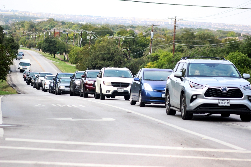
As the area has grown, Carlile said she believes issues with traffic have as well.
“It takes me 20 minutes to get two and a half miles to H-E-B on Louis Henna,” Carlile said.
To address the growth and ongoing traffic issues, the city of Round Rock has released a five-year update to its Transportation Master Plan that shows what it will take to build out its road network.
The plan identifies several priority projects the city will tackle in the coming years, such as providing alternative routes to I-35.
Other roadways have been identified for widening, with many two- or four-lane roads someday having up to six lanes carrying traffic in high-volume areas.
Funding for these projects could include state and federal grants, sales tax revenue and roadway impact fees, although the $1.9 billion needed to fully fund the plan has not been identified.
Two-minute impact
Round Rock City Council approved the 2023 Transportation Master Plan on Oct. 12, which identifies an estimated $1.9 billion in road project costs for the city’s future growth. Expanding on and amending the 2017 version, the 2023 plan prioritizes reducing congestion, enhancing connectivity and increasing safety.
Brian Kuhn, Round Rock assistant director of transportation, noted the plan is updated every five to seven years, emphasizing its role as a forward-thinking “vision document.” He said it will help tackle traffic-related challenges before they become problems, as the city tries to address the needs of current and future residents.
Over the years, the city has made a number of efforts ultimately used to build its new transportation plan, including:
- October 2017: The 2017 Transportation Master Plan was approved to address population growth and economic expansion.
- August 2018: City staff began incorporating shared-use paths with road projects to help tie the trail network together.
- March 2019: The city implemented roadway impact fees to offset the cost of city road projects needed for development.
- May 2020: CAMPO released its plan to address congestion and transportation needs in the region.
- June 2020: City adopted policies for safe pedestrian and bicycle travel plus transportation options for local destinations.
- January 2021: New standards for construction projects for the city of Round Rock were adopted.
- March 2022: New standards for construction projects for the city of Round Rock were adopted.
City staff have identified 18 high-priority projects to address immediate needs. These include high-traffic areas, such as Gattis School Road and Red Bud Lane, as well as roadways that could benefit from pedestrian features like shared-use paths.
Master plan projects include corridor studies, roads and trail projects identified in various stages of development, from Kenney Fort Boulevard, which is nearing completion, to the Old Settlers Boulevard extension currently in the design phase.
“Those projects turn into things like Driving Progress, where we go out and build the capacity that our master plan says we’re going to need to deal with new growth over the next several years,” Kuhn said.
Next year is the last year of the city’s first Driving Progress program, in which officials committed a minimum of $240 million in transportation system improvements from 2019-24.
“We’re still working on getting some of the projects for that on the street,” Kuhn said. “We’ve been dealing with utility conflicts. ... But we’re also putting good capacity on the ground like the University Boulevard project.”
The background
Citywide surveys administered every two years show traffic has long been a resident priority.
Carlile, a former accountant for the Texas Department of Transportation, said she believes road congestion has grown to “ridiculous” levels.
To address congestion and enhance connectivity, part of the revamped plan focuses on collector roads, Kuhn said, which guide traffic from neighborhood streets to high-capacity arterial roadways.
“If you don’t have [collector streets], then residential streets often end up filling the function that is supposed to be done by a collector,” Kuhn said.
Another priority of the plan update is addressing road safety in high-crash areas. Using data from studies of the city’s high-injury network—21 miles of roads that have higher rates of crashes—city staff created a safety action plan that commits to reduce fatal and severe crashes by 2045.
Over time, Kuhn said his department hopes to qualify for funding through the Vision Zero program, a national campaign to reduce road fatalities.
“We’re doing a lot of things as a city to make sure safety is a priority,” Kuhn said.
The cost
Initially implemented as a funding strategy for the $1.2 billion in costs associated with the 2017 Transportation Master Plan, the city set a record for annual funding, investing a minimum of $240 million from 2019-24 to improve roadway capacity and connectivity in its Driving Progress program.
The city often uses state and federal funding programs to offset project costs. For example, the safety action plan is included in the master plan with the intent of qualifying for federal funds through the Safe Streets For All program.
City road work can also be financed through the following revenue sources:
- Certificates of Obligation: Debt that can be used to fund projects; doesn’t require voter approval.
- Roadway impact fees: Developer fees to offset costs of city road projects in developments.
- Sales tax revenue: Voters approved a half-cent of sales tax revenue to be used for transportation and economic development in 1997.
- State funds: Can include entities such as Capital Area Metropolitan Planning Organization and the Texas Department of Transportation.
- Federal funds: City officials seek federal grants funds for projects.
Several plan projects are ongoing. The sections of Kenney Fort Boulevard south of Gattis School Road are set to be open by the end of the year, Kuhn said. Many projects are in design phases or have yet to begin at all.
Kuhn said the projects in the master plan will fully build out the city’s transportation system and take an unknown amount of time. Director of Transportation Gary Hudder said road project timelines can take around five years from ideation to being shovel-ready after acquiring clearances.