Residents can now use a new interactive map to find shaded areas in Plano based on the time of day and season.
In a nutshell
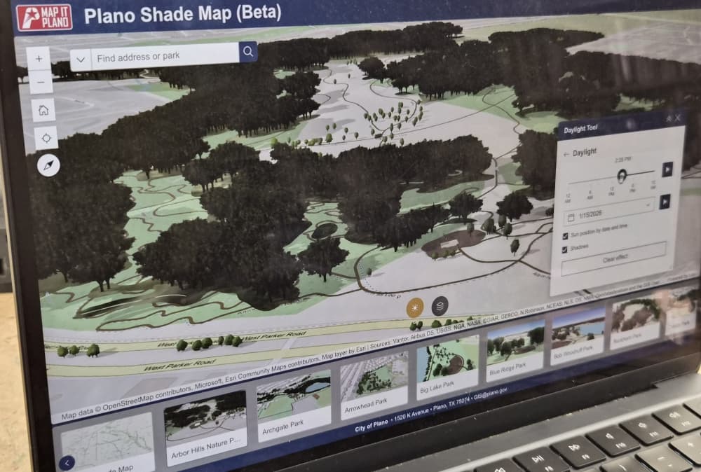
The new Plano Shade Map provides 3D modeling of the city’s green spaces to show shade patterns across the city. The tool is meant to help residents plan visits based on shaded areas in preparation for warmer weather, according to a city news release.
“This tool helps residents take the guesswork out of planning a park visit,” Parks and Recreation Assistant Director Dave Angeles said. “By showing how shade moves throughout the day, it gives people the ability to choose the time and place that works best for them.”
The map lists a number of Plano’s parks for residents to choose from and has a sun button to change the map based on the date and time.
The map is still in a testing phase and may not reflect exact real-world conditions, per the release. It will continue to change as more data is collected.
Dig deeper
Plano’s Parks and Recreation Department took inspiration for the new map after a social media comment from a resident requesting a recommendation of the best times to visit parks based on shade, according to the release.
Data for the map comes from the city’s 2023 Urban Forestry tree inventory. The parks department created an Urban Forest Master Plan in 2017 to address the longevity of the city’s trees for the next 25 years.
Tree shade can improve water quality, air quality and the aesthetics of a city, per city documents.
“Plano’s urban forest is a critical community asset, with more than 43,000 inventoried trees forming the core part of the city’s canopy,” Angeles said in an email to Community Impact.
Angeles said the city records tree removals, replacements and new plantings on a weekly basis. Residents are also encouraged to contact the parks department if trees are not accurately reflected in the shade map so that it can be updated.