
A 36-mile trail initiative could be the next economic railway plodding through neighborhoods across the Austin metropolitan area.
The big picture
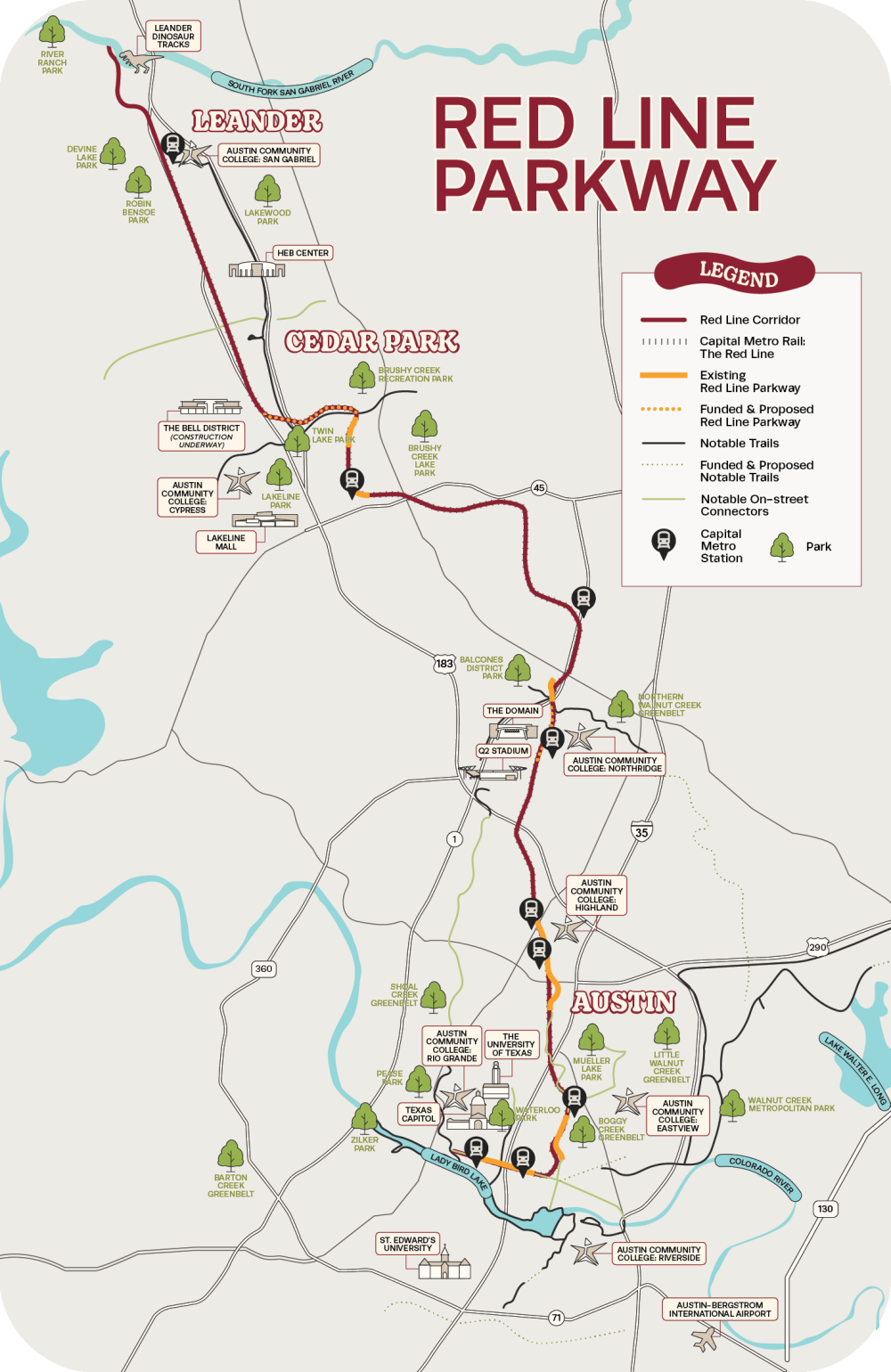
Leaders of what’s known as the Red Line Parkway Initiative are heralding a renewed effort to plot out the remaining 27 miles of trail that would connect neighborhoods from across Austin, extending up into the suburbs.
The Red Line Parkway, conceived over two decades ago, is poised to become the largest trail system north of Lady Bird Lake, connecting major Austin trails in a unique way, said Tom Wald, executive director of Red Line Parkway Initiative.
Economic development leaders likened the proposed trailway to a central business district combined with Main Street and Rainey Street "on steroids." Wald noted that there are not any other trail systems that would connect major trails north of the Colorado River in this way.
The project includes miles of a planned, end-to-end trail along the Capital Metro Red Line corridor from Downtown Austin to Leander, intended to enhance multimodal transportation options.
The vision for the Red Line Parkway follows a transit-oriented development model, with the proposed path weaving along Metro Red Line rail stations, offering a solution for reducing traffic and creating communities where residential and daily needs are easily accessible without a vehicle.
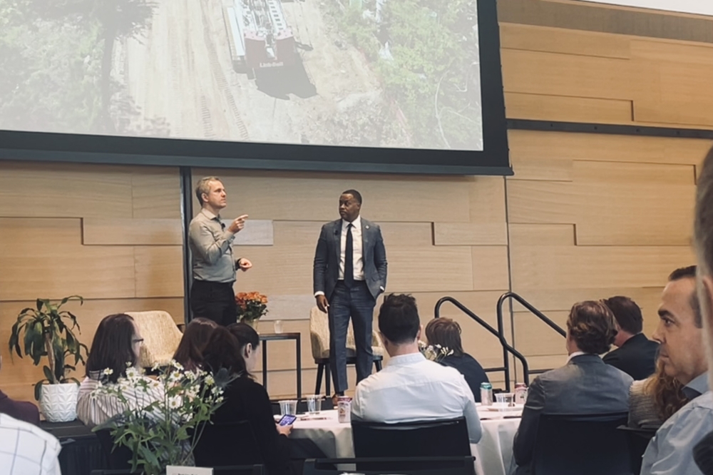
In a recent update Nov. 6 on The Parkway, a similar, successful project was discussed to outline the potential economic benefits of a trail with this scale.
The Atlanta Beltline in Georgia, a 22-mile loop of trails, parks and mixed-use, has become a major draw for both residents and visitors, said Clyde Higgs, president and CEO of Atlanta BeltLine Inc.
The project, which began as a concept in 1999, is arguably the nation's largest redevelopment project, according to the International Economic Development Council. Today, the $719 million project represents an estimated $10 billion economic impact, Higgs said.
“It’s more than just a trail,” Higgs said. “... All the things that you care about in your day-to-day life will exist on The Belt.”
The trail “stitches” together 45 neighborhoods and features a network of public spaces for recreation, local businesses and artwork. Along the route, new restaurants, bars, art galleries, grocery stores and small businesses have sprung up, alongside community programming.
The corridor has generated over 60,000 jobs, according to Higgs.
Outside of the booming business space formed along the public space, the initiative has seen thousands of residential units crop up along the trailway, and leaders have now turned a focus on creating more affordable housing, expected to deliver over 5,600 affordable homes by 2030, Higgs said. The next iteration of development also includes planned transit lines along the trail system.
More than just a “glorified sidewalk,” The Beltline is a comprehensive view of building neighborhoods and community, Higgs said.
A closer look
Higgs said the project’s uniqueness lies in its public-private funding model—the “superpower” behind the Atlanta trail and resulting development.
The Atlanta Beltline project combined local government funding with a special tax on nearby businesses. The local business community agreed to pay this additional tax to help fund the trailway, Higgs explained—something that “will go down in history,” he said.
The concept is similar to what’s known in Texas as a tax increment reinvestment zone, or TIRZ, but it differs slightly—Texas TIRZs designate specific areas where increases in property tax revenue are reinvested to fund improvements and redevelopment within that zone.
In the Atlanta case, the private sector tax generated over $100 million for development of the city trail.
Today, the investment has created an economic hub that supports local and small businesses as well as national employers, Higgs said, citing Microsoft, which is in the midst of planning a new 90-acre campus near the trail in Atlanta.
Austin’s outlook
The Parkway is currently roughly 15% complete with 5.5 of the 36 miles finished.
However, completed portions of the pathway are already widely used. Wald said some completed segments see upward of 1,500 users per day, and an estimated 1 million individuals would utilize the completed trailway within the first year of completion, according to the initiative’s website.
Moving forward, project leaders are looking to initiate a Community Vision Plan and Implementation Strategy.
Last year, CapMetro completed a trail study along its Red Line rail line, determining there was between 50 to 100 feet of right of way available to construct segments of trail. Building off this study, The Red Line Parkway Initiative will now seek public engagement regarding the trail configuration and potential uses and assets.
“There's never been a holistic plan for the corridor that involves the public,” Wald said.
The public engagement period is expected to kick off sometime in late 2026, with a goal of compiling and analyzing results by early 2027 and plan adoption in 2028, according to a news release. The organization is currently fundraising an estimated $500,000 for the $3 million study—$2 million of which is being funded by a recently awarded federal grant.
Areas like North Austin, where many industrial sites are being redeveloped for commercial and residential use, could be well-suited for a transit-oriented development model, Wald noted.
The Red Line Initiative is actively working on several segments of the trail, including:
- Burrell Drive: This Red Line Parkway connector is underway and expected to be completed by next spring.
- Shoal Creek Trail Extension: In partnership with the Shoal Creek Conservancy and city of Austin, this new shared-use path will extend the Shoal Creek Trail to the north, connecting to the Red Line Parkway in North Burnet.
- Bridge over Country Club Creek: The bridge over Country Club Creek was recently completed, providing a connection along the south shore of the Colorado River from Pleasant Valley Road and Longhorn Dam to the Montopolis Bridge and US 183.
- Longhorn Dam Multimodal Improvements project: The "wishbone" bridge across the Colorado River is on track to be substantially completed by the end of the year. It will add to the Ann and Roy Butler Hike and Bike Trail and create a new, beautiful connection from Southeast Austin to East Austin and the Red Line Parkway.