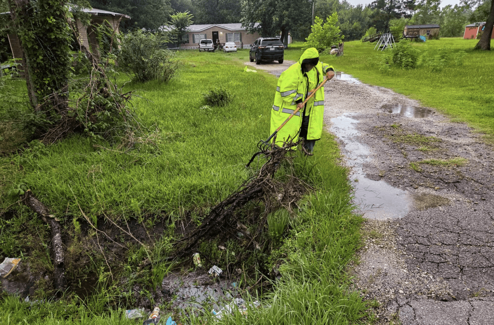
Harris County Precinct 3 crews spent time ahead of the storms clearing drains and ditches of debris to ensure adequate water flow. (Courtesy Harris County Precinct 3 Commissioner Tom Ramsey's Office)
Updated 5:30 p.m., June 16
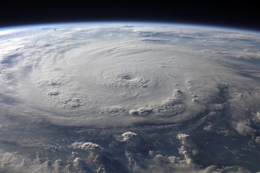
In an updated forecast from the National Weather Service, a tropical storm watch has been issued for coastal counties, with a coastal flood warning affecting the Bolivar Peninsula ahead of a tropical disturbance forecasters expect to become the first named storm of the 2026 Atlantic hurricane season.
While heavy rainfall has calmed down across the Greater Houston area, NWS officials said additional showers will likely affect the region through June 18 as the track for the tropical disturbance becomes more defined.
Officials with CenterPoint Energy held a news conference on June 16 and confirmed that preparations for any power outages, such as truck and equipment staging, have been successful.
“Our CenterPoint team is taking action, and will continue to take all necessary actions, to prepare for the impacts of severe weather on the electric and gas system across Greater Houston," said Jason Fabre, CenterPoint's vice president of special response and incident commander. "We have mobilized more than a thousand additional frontline crew members and activated our Emergency Operations Center. Given the unpredictability of this storm system, we are urging our customers, their families and all those visiting to make sure they are taking the necessary steps to stay safe."
Updated 12:12 p.m. June 16
Several management authorities in the Greater Houston area began reporting lake discharges taking place due to rain June 16.
The Coastal Water Authority reported that Lake Houston was at a level of 42.43 feet at 10:30 a.m. The Lake Houston dam discharge rate as of 12:15 p.m. was 10,269.32 cubic feet per second, according to the CWA.
Meanwhile, according to information from the San Jacinto River Authority, as of about noon June 16, the level of Lake Conroe was 201.19 feet above mean sea level, and outflow was taking place at 529 cubic feet per second as of a 9:37 a.m. update. The normal lake level is 201 feet above msl. SJRA officials said outflows would continue as rain continues in the area, and information can be found at www.sjra.net.
Montgomery County Office of Homeland Security and Emergency Management is sharing updates on its Facebook page regarding flash flood warnings and high water areas in the region.
Posted 11:18 a.m. June 16
Harris County officials are urging caution as the National Weather Service has forecasted multiple days of heavy rainfall across the Greater Houston area.
What you need to know
Officials with the National Weather Service are maintaining a flood watch over a large swath of southeast Texas through June 18.
The watch stems from a semi-stationary front moving across the region alongside a disturbance in the Gulf with a 60% chance of developing into a tropical storm before bringing additional rainfall to the region, NWS officials said.
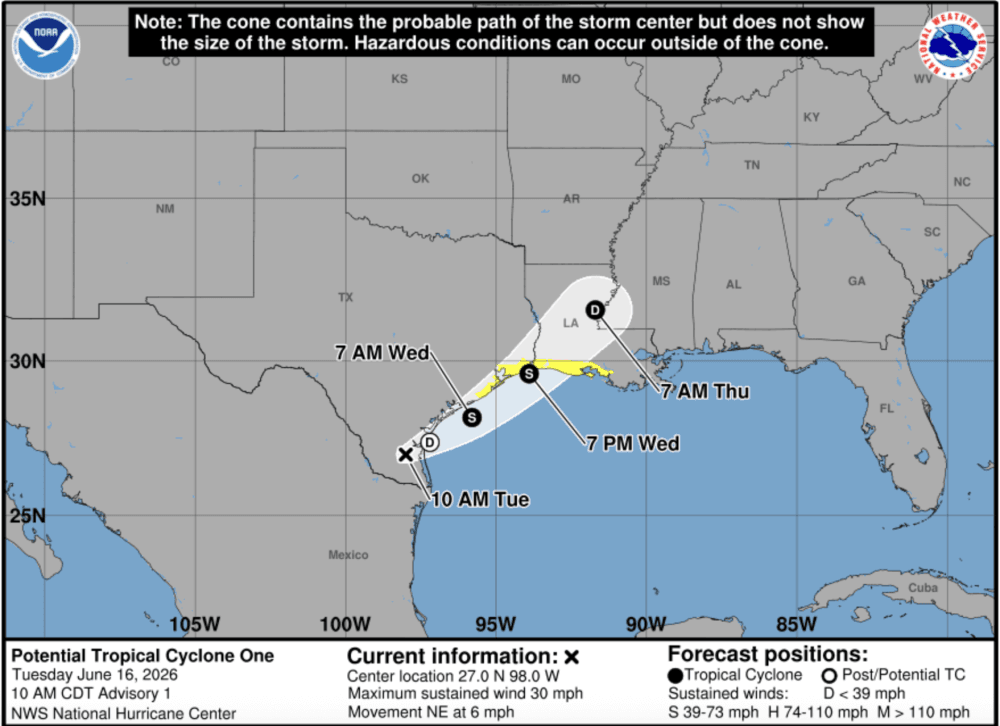
According to the National Weather Service, the tropical disturbance is projected to become Tropical Storm Arthur, and tropical storm watches have been issued along the coasts of Texas and Louisiana.
The National Weather Service has issued Tropical Storm warnings along the Texas and Louisiana coasts. (Courtesy NWS Houston/Galveston Office)
“Regardless of development, the primary concern remains periods of heavy rainfall and flash flooding,” NWS forecasters said in a June 16 news release. “Though heavy rainfall is possible areawide, the highest risk of flash flooding over the next few days will be across our southern and coastal counties.”
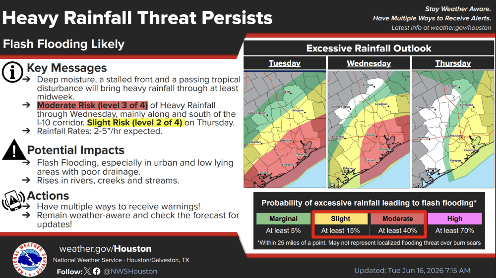
Data from the NWS shows the Houston area received 2-4 inches of rain, with certain areas receiving slightly more June 15. However, the agency said the area could see 4-7 inches of rain through the end of the week, with isolated areas reaching up to 10 inches or more of rain through June 19.
The National Weather Service is forecasting additional heavy rainfall through June 19. (Courtesy NWS Houston/Galveston Office)
What’s being done?
Gov. Greg Abbott signed a disaster declaration for 101 counties in southeast Texas, including Brazoria, Harris, Montgomery, Fort Bend and Galveston counties June 15.
"Texas is prepared to respond to the severe weather threats that continue to move across our state," Abbott said. "Texans should heed the guidance of state and local officials and take all necessary precautions to stay safe during this severe weather."
Harris County and the city of Houston have also activated emergency response initiatives, such as lowering Lake Houston levels ahead of additional rainfall.
“We are taking every step to prepare for this weather and keep our community safe,” Houston Mayor John Whitmire said in a June 15 statement. “I urge residents and visitors alike to stay informed, use caution on the roads, and never drive through flooded streets. By working together and following official guidance, we can help keep everyone safe.”
Ahead of the storms, Harris County Precinct 3 Commissioner Tom Ramsey and Precinct 4 Commissioner Lesley Briones conducted ditch and drain clearing operations. Meanwhile, Harris County constables and other law enforcement agencies are monitoring any high-water crossing areas.
Houston Airports officials have also urged passengers with flights to be prepared for potential weather-related delays at both George Bush Intercontinental and William P. Hobby airports.
Before you go
State and county officials are asking residents to remain aware of weather changes through the end of the week due to forecasted heavy rain and flash flooding.
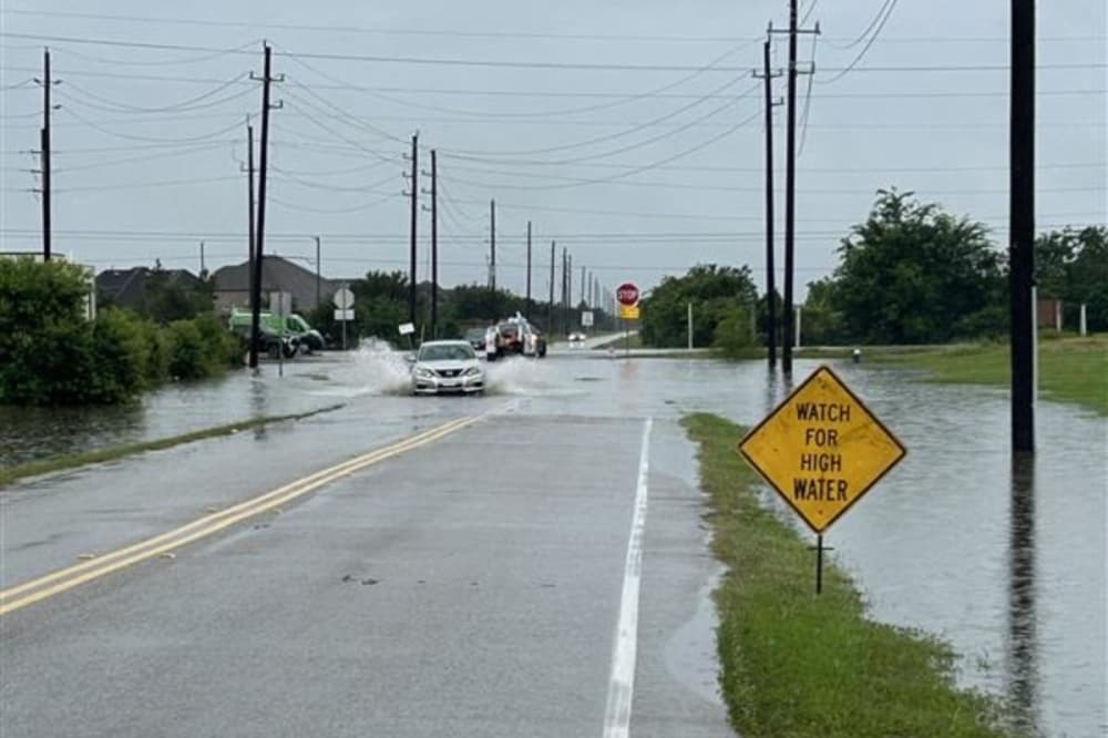
Residents are urged to remember to avoid driving through flood waters and other hazardous conditions.