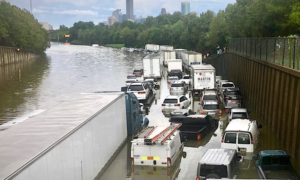
The new FEMA flood maps will take into account flooding from Hurricane Harvey in 2017. (Community Impact staff) (Shawn Arrajj)
West University Place’s flood maps could look different in a few years.
What's happening?
On March 9, West U city officials heard from experts on what the Federal Emergency Management Agency’s proposed flood maps look like after several large flooding events were taken into account since 2015.
Emily Woodell, chief external affairs officer with the Harris County Flood Control District, presented the updated flood maps to City Council on March 9.
This is one of the first steps of a long process, Woodell said.
Some background
After Hurricane Harvey, there was consensus from different jurisdictions across Harris County that the experiences people saw during the 2016 Tax Day flood, 2015 Memorial Day flood and Hurricane Harvey in 2017 did not match what was presented on the current maps. Woodell said the county agreed that upgraded maps were needed.
The HCFD partnered with FEMA to do an advanced modeling of flood maps that account for increased rainfall rates.
“We saw 30% increase in rainfall rates from the National Oceanic and Atmospheric Administration, and this also accounts for updated topography,” Woodell said.
More details
The preliminary map also accounts for major projects that have happened in recent years, such as Brays Bayou.
“Currently, the maps are out and with the floodplain administrators for initial review,” Woodell said. “That means that floodplain administrators are allowed to look at those maps from their vantage point to provide comments, and share that information with residents.”
From there, FEMA will release additional information about steps for different models before it moves to the official public comment process.
Three important things to note about the process, Woodell said, are:
The planning is still in its early phase, so the maps do not “have teeth” to regulate development or impact insurance rates.
The community has multiple opportunities for input, through both floodplain administrators and FEMA.
Project Brays is a part of the preliminary models.
“We are looking at at least two to three years before these maps become adopted officially by FEMA,” Woodell said.
Mapping it out
The current preliminary maps do not include West U’s current drainage projects, such as the East Side Drainage Project. Projects must be fully constructed to be part of the models, and there was a cutoff time for 2020.
“In this phase of the project, we're really looking for what is on the maps as of 2020,” Woodell said. “So we want to make sure that that feedback lines up with what was on the ground at that time. After the maps are adopted, there are processes that the city and other municipalities can go through to have those projects amended into the maps.”
This makes the process go quicker and smoother than a major map overhaul, she added.
The local impact
Tim Buscha, president of IDS Engineering Group, who works with the city, added that the local projects, like the East Side Drainage Project and Poor Farm Ditch, will serve mitigation needs adjacent to the community.
“Those are not river marine projects or projects that would directly impact, probably, what will happen on Brays,” Buscha said. “So we probably wouldn't see much any kind of map change from a global map to a FEMA map.”
However, there have been reductions in flooding in West University since the Brays Bayou was upgraded in 2022, Buscha said.
For example, around the Poor Farm Ditch area, the water elevation level is about 48.8 inches, in comparison to 49.3 inches in the previous map.
“Project Brays actually reduced, even with the higher rainfall, water surfaces a little bit in this area compared to the existing 100-year [floodplain],” Buscha said.
Buscha added that they have not determined how many homes were in the floodplain, but they can look into it. Insurance will also not be affected by the new maps at this time, he said.
“The new FEMA tool that the National Flood Insurance Program uses will take this future map three years from now, and overlay your home,” Buscha said. “And as long as the area that your parcel has wasn't impacted, that usually would not make your insurance go up.”
Still, some areas will see a different rate because of the updates, or because they are adjacent to a 500-year floodplain area.
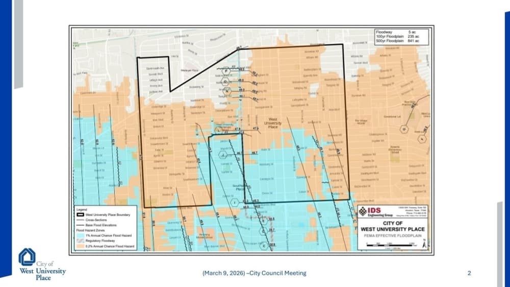
The current flood map for West University Place. Blue represents the 100-year floodplain and the brown represents the 500-year floodplain. (Courtesy city of West University Place)
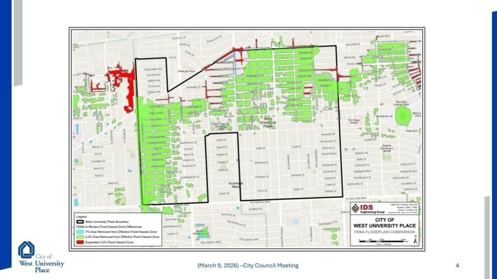
The preliminary flood map for West University Place. Green represents an area that has been removed from the 500-year floodplain. Red shows where it grew. (Courtesy city of West University Place)
What’s next
It will be approximately three years before the maps are official, according to HCFCD. However, in June, FEMA is expected to issue the preliminary maps and models to the public.