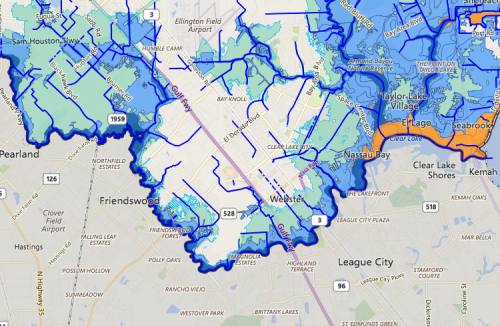
City leaders and council members on Monday reaffirmed their decision to allow the city's Harris County homeowners to begin rebuilding at ground level in areas that could flood again, according to revised flood maps.
"Without repealing those maps, we would have told a number of our homeowners, effectively, 'You can't move back into your home, and now your property is worthless,'" Assistant City Manager Morad Kabiri said in his remarks to the council.
In November, Friendswood City Council voted to revert to the 1999 flood maps instead of following new maps developed by a Harris County study conducted after Tropical Storm Allison in 2001. FEMA never adopted those maps, Kabiri said, so homeowners in newly identified flood-risk areas were uninformed about whether they should purchase flood insurance. The city adopted them in 2007.
"These maps were intended to identify risks and ultimately educate property owners to secure insurance," he said. "Because of the lack of recognition on FEMA's part, a number of our homeowners in the Harris County side of Friendswood did not have insurance that should have had insurance."
Council Member Jim Hill, who sits on the board of directors for the Clear Creek Watershed Steering Committee, said the maps have been an ongoing issue.
"The federal government drags its feet. They are the reason a lot of our citizens didn't have flood insurance," he said.
A recent report by the Houston Chronicle brought attention to the city's decision to allow ground-level rebuilds in an area known to be at risk for floods, without requiring the homes be elevated.
"I think we did the right thing," Council Member Steve Rockey said. "And if that vote was here tonight, I'd make the same vote again, every single time."
Company
Sign in or create free profile


